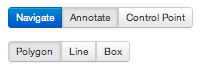
Annotation
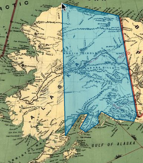
Annotations can easily be added by creating overlays on top of map images.
A window will pop up, prompting you to add an annotation for that region. While you are typing your annotation, Maphub will suggest possibly relevant Wikipedia tags for your annotation.
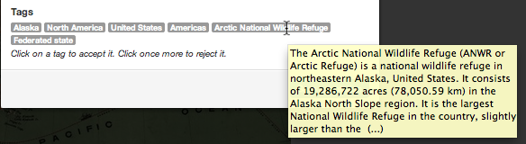
You can either accept or deny these tags. Accepted tags will then be linked to the annotation and support multilingual map search and retrieval.
GeoReferencing
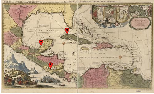
Control points may be added to each map.
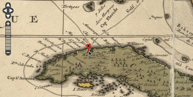
Each control point is associated with known geographic coordinates.
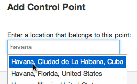
After at least three of these points are added to the map, a geographic model can be computed for the map. Maphub will then be able to prompt the user with more locations as well as generate possible tag choices for annotations.
Multilingual Search
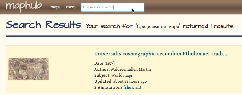
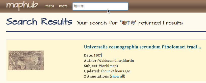
Annotations and Control Points connect maps with globally connected data sources - such as DBpedia. It is then possible to exploit those connections to enrich annotations and their tags with additional information, such as the ability to search for a map by its content and not its title, and translations of terms in other languages.
Searching for the term Mediterranean Sea

will return the Waldseemüller map in any Wikipedia-supported lanuguage since it has a tag linking the term to the map.
For example: Russian,
or Japanese...
Map Overlays
After adding at least three control points to a map it is possible to calculate real world locations for any point on the map. This allows us to create different views through Google Maps
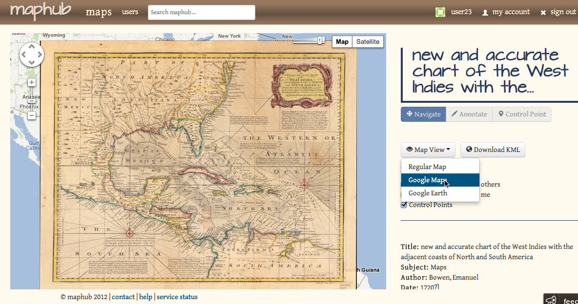
and Google Earth.
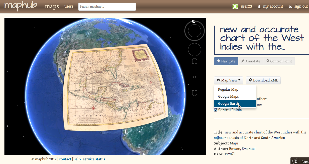
These views will create an overlay of the historic map onto its current day location. The Google Earth file can also be downloaded to your computer for a later viewing.

About Maphub
Maphub in an online application for exploring and annotating digitized, high-resolution historic maps. All user-contributed annotations are shared via the Maphub Open Annotation API. The first demo has been bootstrapped with approximately 6000 public domain maps taken from the Library of Congress Historic Map division.
Technical Details
Maphub is implemented on the Ruby on Rails web framework and uses Apache Solr for map full-text search. Tag suggestions are coming from Geonames and Wikiminer and semantic tag enrichments are retrieved from DBPedia. magicktiler and OpenLayers are used to create and display zoomable raster images. Google Map/Earth overlays are being generated using GDAL2Tiles. The Maphub Open Annotation API follows the W3C Open Annotation specification. Maphub reuses code previously developed for the YUMA annotation framework.